With the end of hurricane season here, it is time to get out there sailing.
No more of that nasty stuff expected
We plan on heading south this season and ‘following our noses’ for a change rather than having a distinct destination.
Do not get me wrong, we have a general idea where we want to go, but how long we stay at any one place is ‘up in the air’.
Panama, and its surrounding islands, are out of the Caribbean’s hurricane belt, so once you are that far south-west you are no longer restricted by the seasons. Do not get me wrong, you still get cooler winters with consistent winds and hot summers with little wind and lots of thunder storms. Just no hurricanes swinging your way!
There are a multitude of lovely islands to explore both on Panama’s eastern and western coastlines. We plan on getting lost amongst them for a bit.
The past three years we have been ‘voyaging’. The first year we were pressed to get down northern Europe and across the Atlantic.
The second year we made it all the way up the Eastern Caribbean, through the Bahamas and into the United State.
This last sailing season we felt pressed to keep moving south as we made our way back through the Bahamas to Cuba, Mexico and Belize.
Without a seasonal schedule this year, it will be nice to just wander, and if we like a place, hang out for a bit.
Our only restrictions this season are a few guests. We have to make sure we are there when their flights arrive!
I have already told you that family is coming from Canada for Christmas (see previous blog). We are hoping Roatan (Bay Islands of Honduras) will be a fun place for them to swim, snorkel and learn to dive.
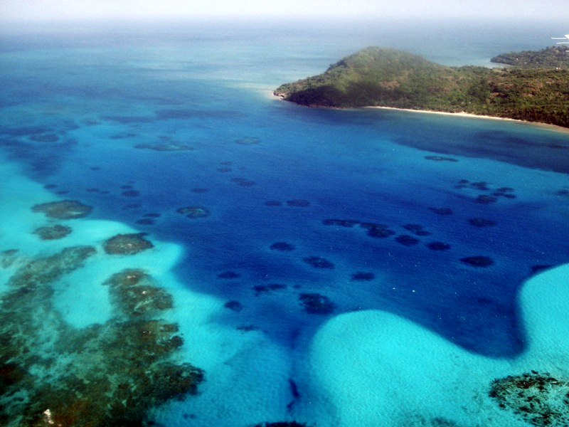
The island of Roatan, Honduras, surrounded with reefs and beaches.
Then we have January and February to do some more diving and make our way through the rest of the islands off of Central America. Providencia (Columbia) is definitely on our list of stop overs.
The island of Provindecia, Columbia
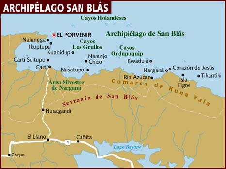
Then it is the cluster of islands off Panama’s south-east coast, called the San Blas Islands, that we plan to get lost in for a while.
Considered an autonomous region, the chiefs of the inhabited islands here have done their best to save their traditional way of life, but are still open to respectful visitors.
Our dear friend from England, Steve Reed, is planning on joining us here for a bit in March.
Near the end of next year we want to be up in the Bocas del Toro region of Panama. Unless we learn differently, this looks like a good place to haul the boat out of the water for a fresh coat of anti-foul paint before heading to the Panama Canal.
The passage through the Panama Canal is an adventure. We are fortunate to have lots of volunteer ‘line handlers’ for this step of out journey. Panama City is also the best place to stock up before heading over to the Pacific side.
Then there are lots of islands to explore on the Pacific west coast of Panama. We will have to decide between heading north up to Costa Rica or out to sea and the passage to the French Polynesian Islands.
But that would be a good year from now and we do not have to decide yet. You never know what could happen between now and then.
At the moment we are still in the Rio Dulce river of Guatemala finishing up boat maintenance, then we have a big ‘gut, clean and organize’ so we can get stocked up for the islands to come.
We will do our best to find internet along the way and keep you all informed of the ‘mishaps’ we get up to.


5 thoughts on “Guatemala to Panama – Plans for the next sailing season”
Your travel plans sound great. What an adventure! Very hot here in Sharm el Sheikh, but you have probably see on the news that I may be here a while! No problem for me, having a great time.
Just do it. The Pacific crossing is a doddle. We’re in Vanuatu right now but have decided to go to Australia for the cyclone season and will head up to the Solomons and PNG next year.
Hope you’re all well
Love xx
Dear Phil and Sara,
Great to hear from you! We check up on your Pacific progress regularly and hope to join you soon.
We are following in your footsteps and have managed to source cruising guides for most of Central America but are struggling to find reasonably priced paper charts from Mexico down to Panama. Have you found a good source??? If so, we would be grateful if you could share. Regards Richard & Jan
Dear Richard and Jan,
Reasonably priced charts are difficult to get your hands on. The best source is other cruisers. As you travel south you will run into cruisers traveling north. It is very common to exchange paper and digital forms of charts and guide books.
I will warn you that most of the charts for the Western Caribbean are scornfully out of date and inaccurate. I would not waste money on them for anything more than passage planning. For approaches you will need the information and waypoints available in ‘up to date’ cruising guides such as Mexico and Belize by Raucher, and Panama by Bauhaus.
PDF (digitalise) any guide books or charts you do have so, even if you do exchange the paper copy with another cruiser, you still have the digital form as a trading tool.
Scanners and printers have really dropped in price and you might want to bring one or both with you. We have used both more in the Western Caribbean than any where else so far on our travels.
Hope this information is helpful and we will try and send you links to digital sources of maps later.
Happy sailing,
Quinnster